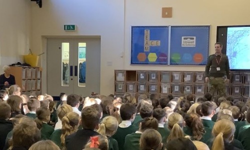
Major Gleave, a Military Geographer in the Royal Engineers Major Gleave joined us again today, on the morning gate to welcome our children into school, and to give a whole school assembly on the applications of Geography in a military setting.
He told us about the time he was on operations in Afghanistan and his role as a Battle Group Engineer which involved being a military geographer for a Lashkar Gar region in Helmand Province. The children were taught about the differences in Human and Physical Geography and the importance of water for both the people and crops.
Following this he kindly conducted two sessions of map appreciation for our remaining year 6 pupils. Here, he taught the children about the different types of maps, their uses and the multitude of layers used to create a map. A favourite for all the pupils was the aerial photograph maps, taken from space by satellite, which Major Gleave used to highlight the angle of the sun, crop rotation and season of the year. All the children were super engaged with all the content both in the assembly and during the map session. Their powers of deduction, reasoning and general interest in the subject was wonderful to see.